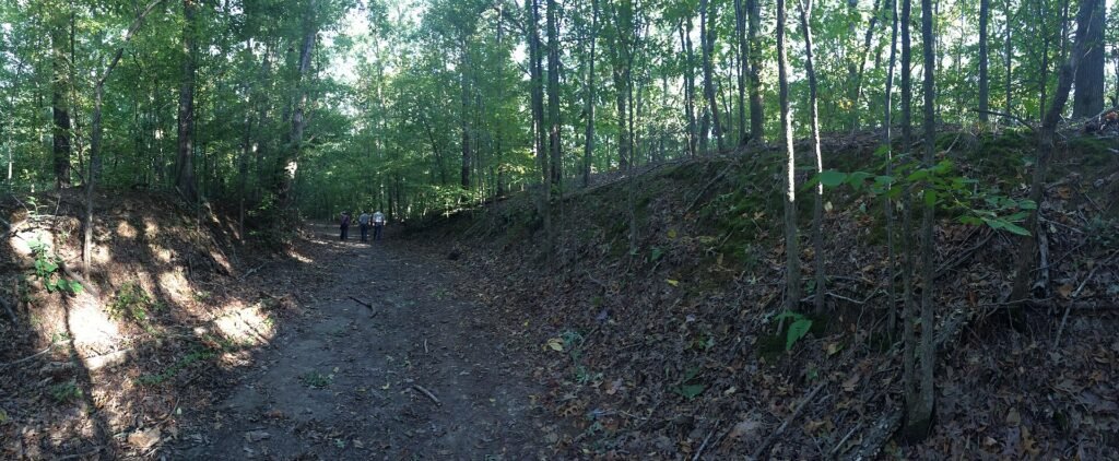
The Trail of Tears was the forced removal of five Native nations from the Southeast to Indian Territory, now Oklahoma, mostly in the 1830s. The name covers many routes and several years, not one road or one trip. The U.S. removed the Cherokee, Muscogee (Creek), Choctaw, Chickasaw and Seminole nations, and all five live on today (National Park Service).
Key facts
- President Andrew Jackson signed the Indian Removal Act on May 28, 1830 (National Archives).
- In the 1830s, the U.S. removed about 16,000 Cherokee, 21,000 Muscogee (Creek), 9,000 Choctaw, 6,000 Chickasaw and 4,000 Seminole (NPS).
- About 4,000 of 16,000 Cherokee died during their removal in 1838 and 1839 (National Archives).
- The Trail of Tears National Historic Trail covers 5,043 miles of land and water routes in nine states (NPS).
- The federal list of January 30, 2026, names 575 tribes, including all five nations (Federal Register).
This page is part of our Native American history section.
Who was forced to leave on the Trail of Tears?
Five nations from the Southeast were forced west: the Cherokee, Muscogee (Creek), Choctaw, Chickasaw and Seminole (NPS).
| Nation | Homeland | People removed (NPS estimate) | Main removal years |
|---|---|---|---|
| Cherokee | Georgia, North Carolina, Tennessee, Alabama | About 16,000 | 1838 to 1839 |
| Muscogee (Creek) | Georgia, Alabama | About 21,000 | 1836 to 1837 |
| Choctaw | Mississippi, Alabama | About 9,000 | 1831 to 1833 |
| Chickasaw | Mississippi, Alabama, Kentucky, Tennessee | About 6,000 | Mostly 1837 to 1851 |
| Seminole | Florida | About 4,000 | Mostly 1835 to 1842 |
The Choctaw were the first of the five to be removed (Choctaw Nation). The Chickasaw were the last to leave. Their leaders negotiated the move and used land-sale money to supply their people (Chickasaw Times).
Other eastern nations were removed too. By the 1840s, the government had forced nearly every eastern tribe west (National Archives). Meet one nation on our Cherokee Nation page.
Why did the United States force the nations to move?
Settlers wanted Native land for farms and gold, and the 1830 Indian Removal Act let the President make treaties to move eastern nations west.
The Indian Removal Act
Jackson’s government signed almost 70 removal treaties and moved nearly 50,000 people west. That opened 25 million acres to white settlement and helped slavery spread in the South (National Archives). Our page on the effects of colonization tells the longer story.
Gold in Georgia
The first written report of gold in Georgia appeared on August 1, 1829. By late 1829, thousands of miners had rushed onto Cherokee land (New Georgia Encyclopedia). The Cherokee Nation says it was forced west “after gold was discovered in our homelands” (Cherokee Nation).
Worcester v. Georgia
Georgia jailed missionary Samuel Worcester for living on Cherokee land without a state permit (National Archives). In Worcester v. Georgia (1832), the Supreme Court ruled for Worcester (Library of Congress). Chief Justice John Marshall wrote that Indian nations were “distinct, independent political communities retaining their original natural rights” (New Georgia Encyclopedia). Georgia ignored the ruling, and Jackson did not enforce it.
Myth check: Jackson is widely quoted as daring Marshall to enforce the ruling himself. That short, dramatic line keeps spreading. His real words, in a letter to John Coffee, were “The decision of the supreme court has fell still born, and they find that it cannot coerce Georgia to yield to its mandate” (New Georgia Encyclopedia). Always check a famous quote.
Many Cherokee opposed the 1835 Treaty of New Echota, signed by a small group. In 1838, General Winfield Scott and 3,000 troops forced them out (National Archives).
What routes did the five nations travel?
People traveled west on existing roads and rivers, on foot, by wagon and by boat (NPS).
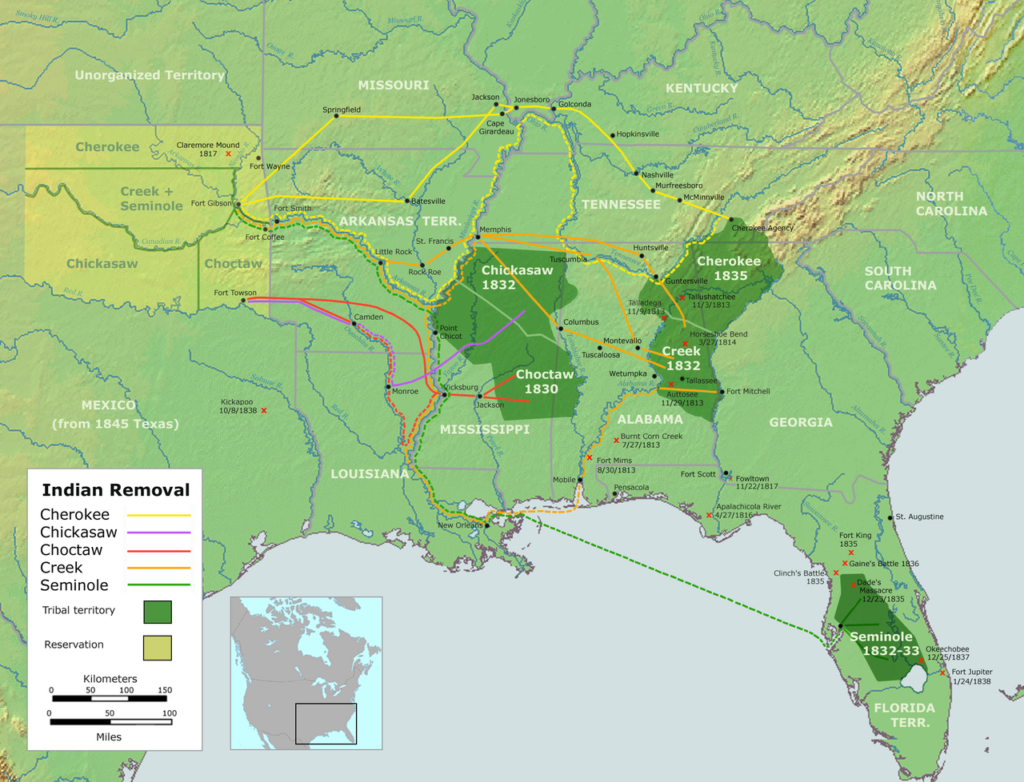
- Cherokee: 17 groups called detachments went west, and 11 used the northern route (NPS). Some walked as many as 1,000 miles over four months (National Archives).
- Muscogee (Creek): In 1836, about 2,500 people, some in chains, were marched to Montgomery, Alabama, and put on barges. The journey covered over 800 miles by land and 400 more by water (NPS).
- Choctaw: Delays, severe winter weather and disease made the journey far worse than promised (Choctaw Nation).
- Chickasaw: People traveled more than 600 miles west, in a season their leaders chose (Chickasaw Times).
- Seminole: Many fought removal in a war from 1835 to 1842. The Army captured many and sent them west (Seminole Tribe of Florida).
Oo-loo-cha, a Cherokee woman, remembered in 1842, “The soldiers came and took us from home” (NPS).
How many people died on the Trail of Tears?
No exact count exists. For the Cherokee, hundreds died on the trip and thousands more died from the effects of removal (NPS).
- Cherokee: “Approximately 4,000 of 16,000 Cherokees died along the way,” according to the National Archives. That is 4,000 divided by 16,000, or 1 in 4. The Cherokee Nation also counts nearly 4,000 deaths (Cherokee Nation).
- Choctaw: The Choctaw Nation says about 15,000 Choctaw made the trip from 1831 to 1833, and “One-quarter to one-third perished from disease, starvation, exposure and murder” (Choctaw Nation). The NPS count of 9,000 is lower.
- Muscogee (Creek): In 1832, 21,792 Muscogee lived in Georgia and Alabama. Twenty years after removal ended, 13,537 lived in Oklahoma. The NPS says the Muscogee and related tribes lost a larger share of their people than the Cherokee (NPS).
- Seminole: By 1842, removal had caused the death or capture of more than 3,000 Seminole people (Seminole Tribe of Florida).
- Chickasaw: People suffered hardship and death, but the Chickasaw Nation gives no count (Chickasaw Times).
Each source counts in its own way, so do not add these numbers into one total.
Where do the five nations live today?
All five nations rebuilt their governments in Oklahoma, and some relatives stayed in the Southeast. “Today the Cherokee and other removed tribes endure as vigorous Indian nations,” says the National Park Service (NPS).
- The Cherokee Nation has its capital in Tahlequah, Oklahoma, and makes its own laws (Cherokee Nation). The Eastern Band of Cherokee Indians is made up of those who stayed and rebuilt in North Carolina (EBCI).
- The Muscogee (Creek) Nation named its capital, Okmulgee, after its original capital in Georgia (NPS).
- The Choctaw Nation of Oklahoma was founded by people forced from their homelands (Choctaw Nation). The Chickasaw bought land from the Choctaw in Indian Territory in 1837 (Chickasaw Times).
- The Seminole Nation of Oklahoma is the fifth of these removed nations with a government in Oklahoma today (Federal Register). The Seminole Tribe of Florida says the American goal of Seminole removal “was never realized” (Seminole Tribe of Florida).
The 2026 federal list includes all of these nations, plus the Mississippi Band of Choctaw Indians and the Poarch Band of Creek Indians (Federal Register). Each has its own government. Compare other nations on our major Native American groups page.
Can you visit the Trail of Tears today?
Yes, Congress created the Trail of Tears National Historic Trail in December 1987, with sites in nine states from North Carolina to Oklahoma (NPS).
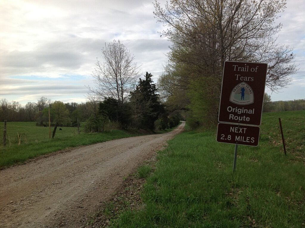
Some pages, even one NPS page, still give an older length of about 2,200 miles (NPS). The NPS FAQ now lists 5,043 miles (NPS), so check the date on any fact. It is not one continuous path, and much is private land, so ask owners first.
Try this: map the removals
- On a blank U.S. map, color each nation’s homeland states from the table.
- Mark Indian Territory, now Oklahoma.
- Draw an arrow from each homeland to Indian Territory. Label it with the removal years and the NPS count.
- Visit one nation’s website in the Sources list and write one thing it does today.
Think about it: Why might the Choctaw Nation’s count differ from the NPS count? Explore our US history section or our Native American Heritage Month page.
Sources
- National Park Service. Trail of Tears FAQ
- National Park Service. What is the Trail of Tears?
- National Park Service. Trail of Tears National Historic Trail
- National Park Service. The Trail Where They Cried
- National Park Service. The Muscogee Nation
- National Archives. Jackson’s Message to Congress ‘On Indian Removal’
- National Archives. Notice of the Supreme Court’s Opinion in Worcester v. Georgia
- Library of Congress. U.S. Reports: Worcester v. the State of Georgia (1832)
- Federal Register. Indian Entities List, January 30, 2026
- Cherokee Nation. About the Nation
- Eastern Band of Cherokee Indians. Government
- Choctaw Nation of Oklahoma. The Trail of Tears: Why We Remember
- Chickasaw Nation. Tribe Turned Removal Trauma into New Successes
- Seminole Tribe of Florida. The Long War
- New Georgia Encyclopedia. Worcester v. Georgia
- New Georgia Encyclopedia. Gold Rush